
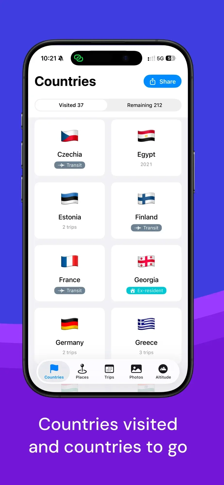
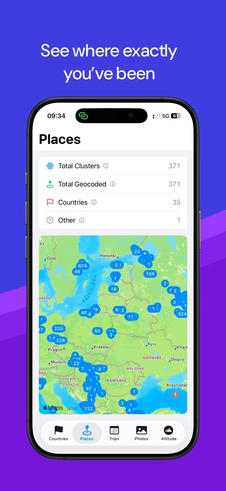
Country Count maps the countries you've visited by reading GPS coordinates embedded in your photo library. Grant photo access once, and it generates an interactive world map against all 195 sovereign nations, organized into a timeline by year and date, entirely offline.
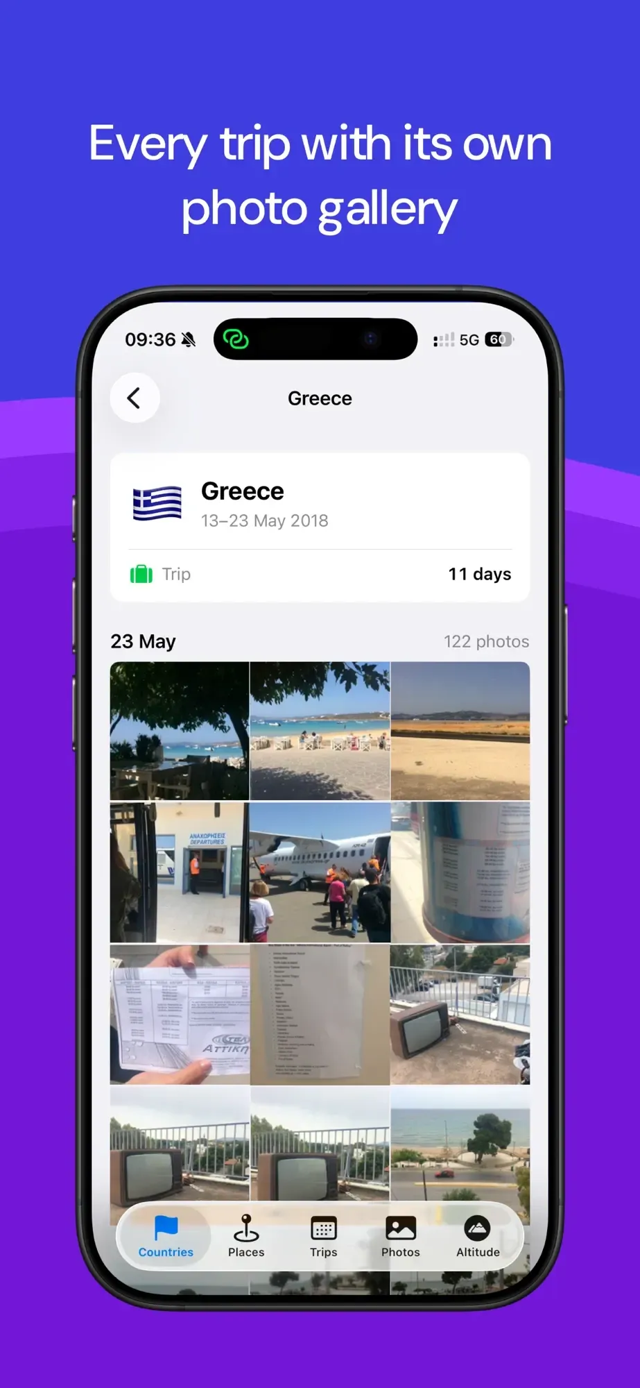
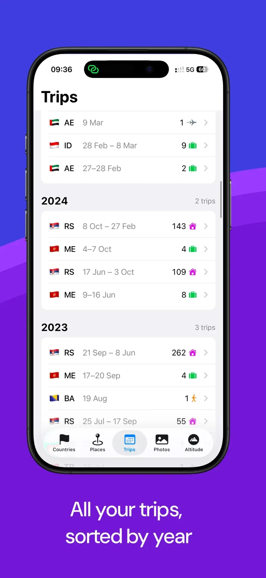
Each country gets its own page with an Apple Maps preview. The visit log organizes entries by year and date, so trips from five years ago surface automatically if your photos have GPS. Manual override handles photos without location data, without modifying the originals. Sharing exports the country list and map in one step.
The design decision that makes Country Count worth covering is the retroactive scan: a photo library full of geotagged shots from years ago populates the map automatically, no manual input needed. Version 1.15 shipped April 28, and the app is too new for an established review record. For iPhoners with a travel habit and geotagged photos already on-device, it handles the tracking that most similar apps ask you to do by hand.
Most travel trackers want you to check in as you go. Country Count assumes you already did, just without the app.